From Barges of Fill to Bedrock Foundations - How Reclamation Actually Works

The J3 Group - Premium Quality Private Tours | Experiences and Insider Chats since 2010
Me Jamie, your host, I am English and I have lived in Hong Kong since January 2nd 1972 - I know the place.
A meaningful blog post with a difference - tips on Travel, Tourism, Tours, Daily Life and my personal thoughts on Hong Kong.
Please do visit Amazing Hong Kong
Hong Kong | Pearl of the Orient


A Resident since 1972 - Private Tours of Hong Kong with Jamie
The Best Things to do in Hong Kong
click on the image to enlarge
© Copyright Acknowledged | All rights reserved | image created by Jamie
Land Reclamation in Hong Kong Explained - The Real Story
Foreword by Jamie
From Barges of Fill to Bedrock Foundations - How Reclamation Actually Works
Land reclamation is one of the subjects that comes up on almost every tour I do. Guests look at the map, look at the skyline, and ask how Hong Kong got so much flat land when the natural coastline is so steep and rocky. My standard short answer for years has been that they bring a whole load of dirt from Mainland China on barges, drop it into the sea and compact it. That is true as far as it goes, but it is only the simplest version of a process that has been refined for more than 170 years and that has changed the shape of the city more than any other single piece of engineering.
This post is the longer version I use when guests want more detail. It covers how the work is actually done, the growth of Hong Kong Island, West Kowloon and the airport, the biggest projects, settlement and safety, and a few points that are easy to miss. It is written for ordinary people, not engineers. I have lived here for more than 50 years and still find the scale of it remarkable every time I walk across land that used to be open harbour.
What a Hectare Actually Means
Before we get into the projects, a quick word on the numbers. Engineers talk in hectares. One hectare is 10,000 square metres. That works out at about 107,639 square feet. Picture a square 100 metres by 100 metres. Or roughly two football pitches laid side by side. The original airport platform at Chek Lap Kok is about 1,248 hectares. That is in the region of 134 million square feet of new land. Central Reclamation Phase 1 was 20 hectares, or a bit over 2 million square feet. Once you see the figures that way they start to make more sense.
How Reclamation is Done in Plain English
The basic idea has not changed much in 170 years. You take a bit of seabed, get rid of or strengthen the soft mud that sits on top of the rock, then pile on fill material until the new land rises above the high tide mark. A seawall goes around the edge to keep the sea out. After that the ground is left to settle, and the builders put foundations that can handle a bit of movement.
Fill material comes from several places. Marine sand is sucked up from the seabed in borrow areas around Hong Kong or further out in the Pearl River estuary.
Currently, some rock fill comes from quarries - Hong Kong currently has only one active local quarry: Lam Tei Quarry in Tuen Mun. It supplies roughly 4 - 7% of the territory’s annual demand for crushed rock products. The great majority of rock fill and aggregates used for reclamation and construction now comes from quarries in Guangdong in Mainland China.
The others (Anderson Road, Shek O, Lamma, and the many smaller ones) have been closed and rehabilitated over the past 20 - 30 years. Lam Tei’s surface operations are themselves winding down, with a pilot underground quarry at the same site starting in 2025 and studies under way for further underground sites (Tsing Yi North and Sham Shui Kok on North Lantau).
Public fill is the clean rubble, concrete and soil from building sites and roadworks that would otherwise go to landfill. In the big projects a lot of sand has indeed come across from Mainland China on barges. The barges are often bottom dumpers. They sail over the spot, open the bottom doors, and the load falls out. Hydraulic filling is another way: sand is mixed with water and pumped through pipelines onto the site like a giant slurry.
There are two main methods. In the dredged method the soft marine mud is scooped out first and taken away, then clean fill is placed on the firmer ground underneath. In the drained or non dredged method the mud stays put. Engineers put in vertical drains (plastic wicks) that let the water squeeze out faster when weight is piled on top. Sometimes they add a temporary extra load of fill called a surcharge to speed the squeezing. Deep cement mixing is a newer trick used on the airport third runway: cement is mixed into the soft mud in situ to stiffen it without digging it all out.
Once the fill is in place it gets compacted. Vibrocompaction or heavy rollers knock the air and water out so the ground does not sink too much later. Seawalls are built from large rocks or concrete blocks. Then the whole lot is monitored for years with instruments that measure how much it is still settling.
It sounds straightforward when you write it down like that, and in principle it is. That is why Hong Kong has been able to do so many large projects. The method is proven and repeatable. But the execution is anything but simple. You are dealing with soft seabeds that can push up mud waves if the fill is dumped too fast or too thick. Logistics involve fleets of barges, precise GPS placement, ground treatment that can take months, environmental controls, and years of settlement monitoring after the land is finished. One wrong calculation and you get uneven ground or stability problems. Specialists, heavy plant and careful sequencing are what turn the simple idea into solid land. The fact that it works time after time is a credit to the engineering, not evidence that anyone could do it with a few barges and a bulldozer.
The Central Reclamation and the Star Ferry Move
The north shore of Hong Kong Island has been pushed out several times. The original coastline in the 1840s sat roughly where Queen's Road Central is today. After the big fire of 1851 the rubble was simply tipped into the harbour to make Bonham Strand. The big Praya Reclamation of 1868 to 1904, pushed by Sir Catchick Paul Chater, moved the waterfront out to what is now Des Voeux Road and Connaught Road. That is why the old buildings feel a bit inland.
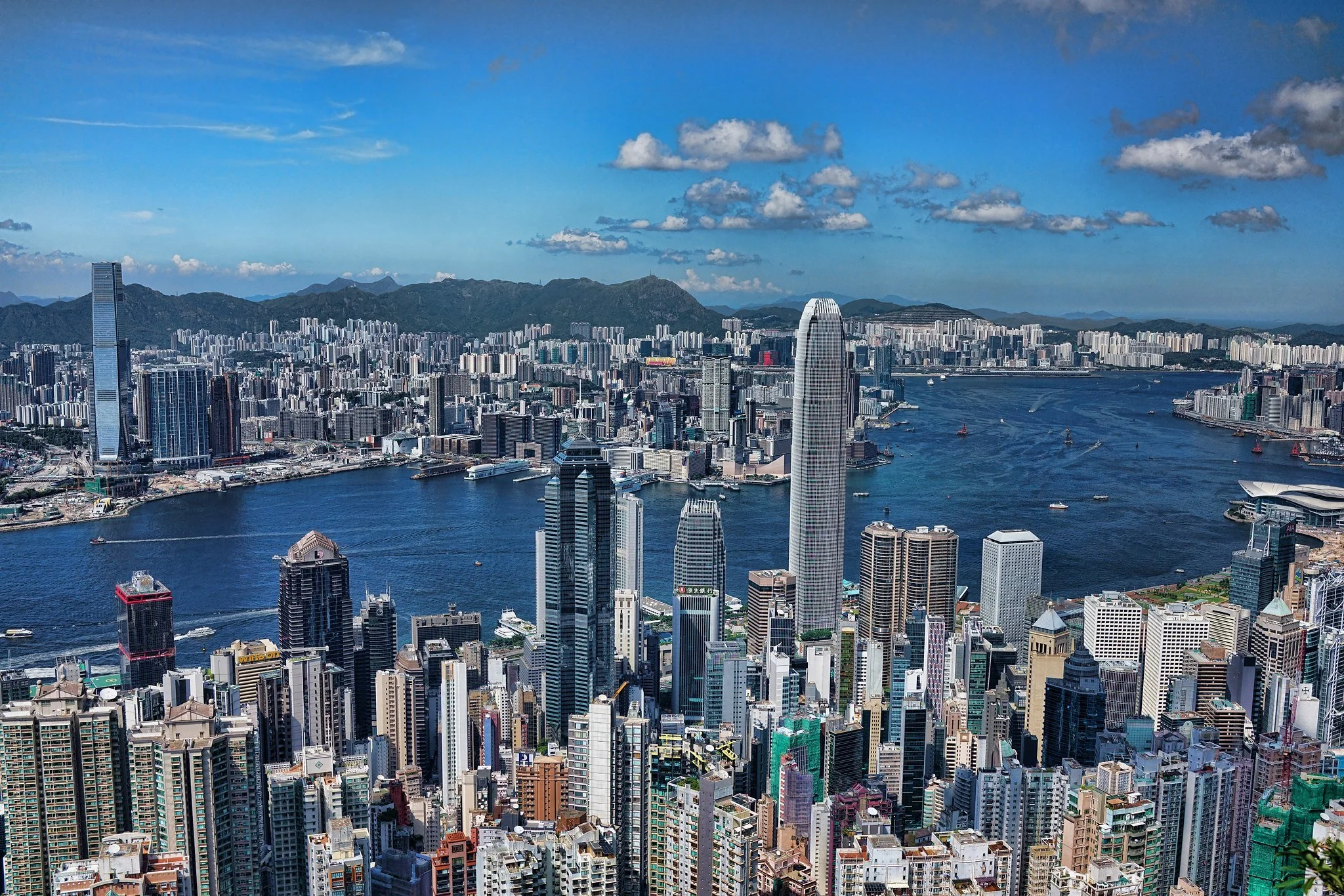
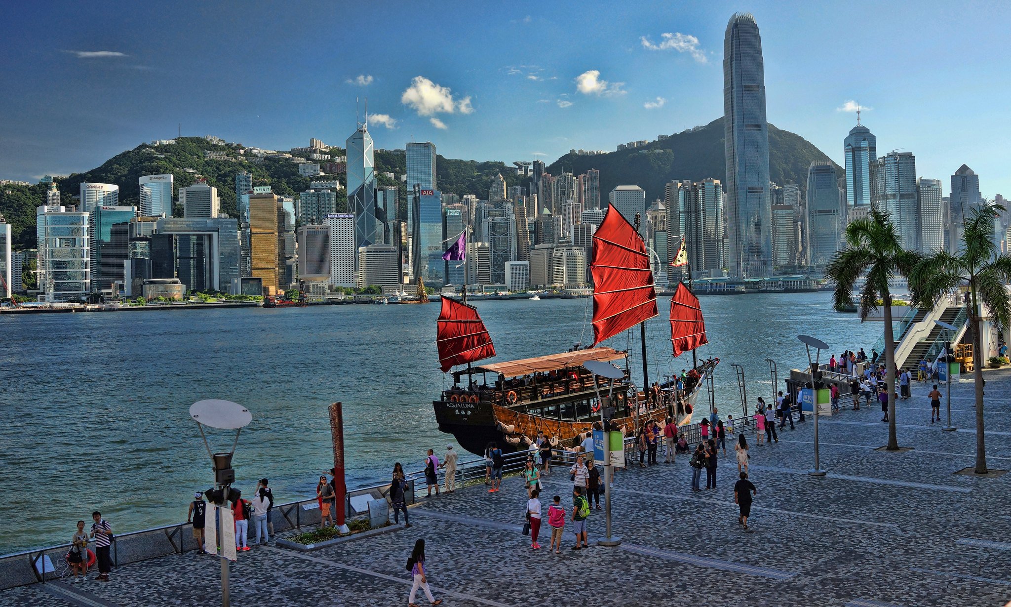
The modern Central work that most people notice is the 1990s and 2000s phases that gave us IFC and the new Star Ferry piers. Central Reclamation Phase 1 ran from 1993 to 1998. It created about 20 hectares of land between Rumsey Street and Pedder Street. That is where Hong Kong Station, the Airport Express, IFC One and IFC Two, and the Four Seasons sit. The seawall alone was 1,100 metres long. Phase 2 filled in the old Tamar Basin for 5.3 hectares. Phase 3, which started in February 2003 and finished the main works around 2011, was originally planned for 32 hectares but cut back to 18 hectares after public opposition. It provided the land for the Central Wan Chai Bypass tunnel, new roads, and the relocation of the Star Ferry piers.
The old Central Star Ferry pier closed on 11th November 2006. The clock tower and the pier itself were demolished to make way for the reclamation and the bypass. The new piers sit further out on the Phase 3 land. A footbridge from IFC Mall to the new pier opened in 2007 and stayed for 19 years until it closed in February 2026 for the Central Yards development.
As a long time resident I am still annoyed that they relocated the Star Ferry Pier, the “new” pier is now at least a 15 minute walk away from Statue Square, back in the day it was 3 minutes, I do however see the bigger picture and what they have done is really quite remarkable.
Early Stages and Later Limits
The very first reclamation in the area was after the big fire of December 1851 in Sheung Wan. Rubble was simply pushed into the harbour to form what became Bonham Strand. That street still runs through the heart of old Sheung Wan, roughly between the current Western Market and the dried seafood shops on Wing Lok Street, just north of Queen’s Road West. It is the clearest everyday landmark for where the systematic northward push began.
The major late 19th century advance that created Statue Square and the land for the later HSBC buildings was the Praya Reclamation Scheme, largely driven by Sir Catchick Paul Chater. It moved the waterfront from roughly Queen’s Road to what is now the area around Des Voeux Road and beyond.
After 1997 the Protection of the Harbour Ordinance established a presumption against further reclamation inside Victoria Harbour. It can still be overridden for an overriding public need, but it is why the big modern projects have been outside the main harbour rather than another large Central fill.
The Central Wan Chai Bypass Tunnel
The road tunnel that runs from in front of IFC eastwards past Causeway Bay is the Central Wan Chai Bypass. It is about 4.5 kilometres long overall, with a 3.7 kilometre tunnel section. It is not an immersed tube like the cross harbour tunnels. Those are built in sections on land or in a dry dock, floated out, sunk into a dredged trench on the seabed, and joined up. The Bypass is mostly a cut and cover tunnel built under or through the reclaimed land along the waterfront.
In the Central and Wan Chai areas the tunnel box was constructed as part of the reclamation works themselves. Diaphragm walls were installed, the ground between them excavated, the concrete tunnel structure built, and then backfilled. In the Causeway Bay Typhoon Shelter section they used temporary reclamation as a working platform. Soft mud was removed, a temporary seawall built, fill placed to create a dry working area, diaphragm walls installed down into the rock, the tunnel box excavated and constructed, then the temporary fill removed and the seabed restored so the typhoon shelter could return to use. There is also a short mined tunnel section under the existing Cross Harbour Tunnel that was excavated by drill and break methods to avoid disturbing the busy tubes above. The whole thing opened in stages in early 2019. It sits under the new waterfront rather than floating in a trench like the harbour crossings.
The Tall Buildings on Reclaimed Land
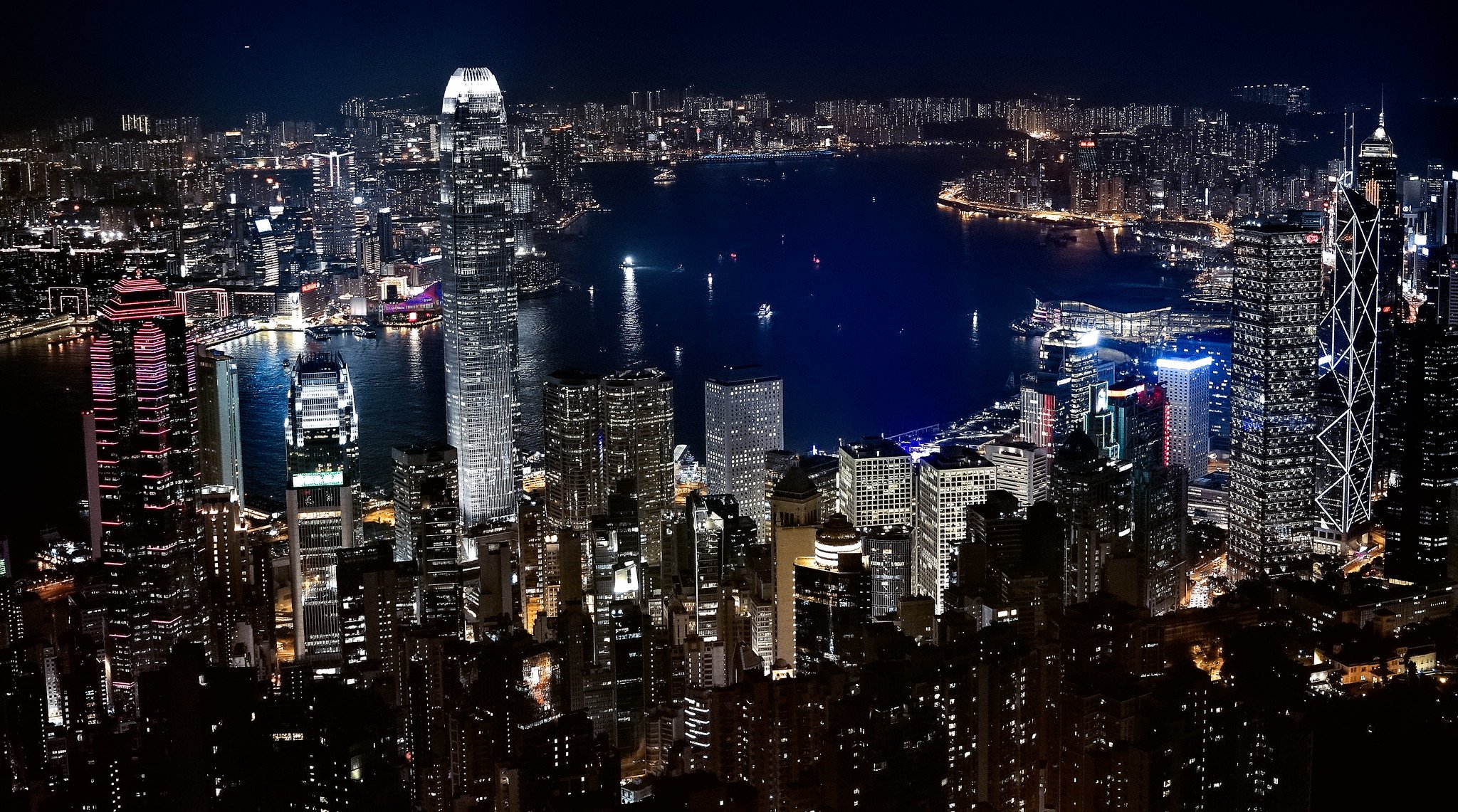
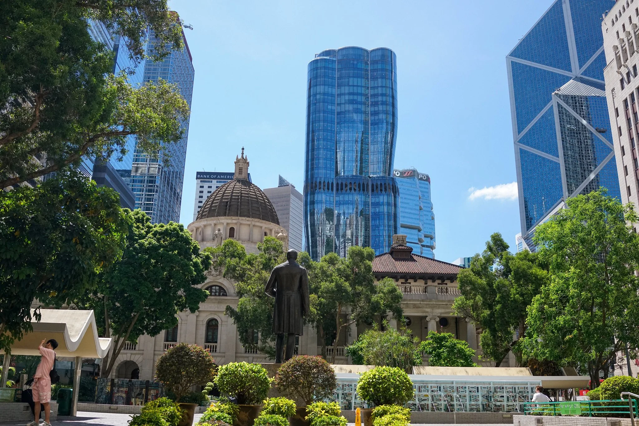
Hong Kong’s two tallest buildings both stand on reclaimed land. The International Commerce Centre (ICC) in West Kowloon is the tallest at 484 metres. It sits on the West Kowloon reclamation above Kowloon Station. Two International Finance Centre (2 IFC) in Central is second at 412 metres and was built on the 20 hectare Phase 1 reclamation of the 1990s.
They are safe from the settlement that happens in the fill because their foundations go down to solid bedrock, not into the soft reclaimed material. For 2 IFC the engineers built a circular cofferdam about 61.5 metres across, lined with thick diaphragm walls, and excavated down roughly 40 metres to the rock. They then poured a 6.5 metre thick reinforced concrete raft foundation directly on the bedrock. The building sits on that rock. The fill around it can settle a little, but the tower does not move with it. ICC used a different deep foundation system of shaft grouted barrettes that also reach the competent ground below. Hong Kong’s tall buildings on reclamation are engineered so the structure is independent of the settling fill. That is standard practice here.
Earthquakes and Reclamation
Hong Kong is in a low to moderate seismic zone. Building codes require design for earthquake loads, and the deep foundations of the major towers are designed accordingly. The bigger long term issue with reclaimed land is not earthquake but differential settlement: the fill and the underlying mud continue to compress slowly under their own weight and under the weight of buildings and roads. That is monitored and allowed for in design. In practical terms the risk of sudden movement is far lower than the gradual settlement that engineers plan for from the start.
West Kowloon
West Kowloon was created in several stages from the 1960s onwards. The earliest work provided land for roads and industrial uses. Between the early 1990s and mid 2003 about 340 hectares were reclaimed from Yau Ma Tei to Lai Chi Kok. That is roughly a third of the old Kowloon Peninsula pushed out by up to a kilometre in places. The cost was around HK$12 billion (about US$1.54 billion). It was part of the Airport Core Programme so the Airport Railway, the West Kowloon Expressway and the Western Harbour Crossing all sit on it. The land is now home to the Union Square towers, the West Kowloon Cultural District, Olympic Station, and a lot of housing. Yau Ma Tei and Mong Kok used to be right on the water with typhoon shelters. Now the water is a long walk past the roads.
The reclamation used the same basic methods of seawalls and controlled fill, with ground improvement where soft mud was present. The International Commerce Centre and the other major buildings on the site use deep foundations to bedrock so they are not reliant on the fill for support. Residual settlement is still monitored across the platform, especially under the roads and open areas, but the structural design of the towers keeps them clear of that movement. The result is a large, relatively flat district that simply did not exist in its present form when I first arrived in Hong Kong.
Hong Kong International Airport at Chek Lap Kok
This is the biggest single reclamation project. The original platform covers about 1,248 hectares. Roughly 75% of it is reclaimed land. The two small islands of Chek Lap Kok and Lam Chau were blasted down from 122 metres to about 6 metres above sea level. Soft mud was dredged out, then hundreds of millions of cubic metres of sand and rock were placed. Figures vary a bit with the source, but the range is 197 million to 367 million cubic metres of material moved. Work ran from late 1992 to mid 1995 for the platform, and the airport opened on 6th July 1998.
Settlement has been the big long term issue. The soft deposits under the fill have compressed. Satellite measurements show up to 40 centimetres of settlement in some reclaimed areas over the first 20 years of operation. Engineers expected it and designed the buildings and runways to cope with residual settlement. It is not the land sliding sideways like a landslide. It is a slow, uneven sinking as the water is squeezed out of the mud layers underneath.
The third runway project added another 650 hectares to the north using non dredge methods and deep cement mixing to reduce the amount of mud that had to be taken away. That work was largely finished by the early 2020s.
Top 10 Reclamation Projects in Hong Kong
Here is a rough ranking of the larger ones since the mid 19th century. Sizes are approximate and some cover multiple phases.
Hong Kong International Airport platform, Chek Lap Kok: 1,248 hectares (1992 to 1995 platform works, opened 1998)
West Kowloon Reclamation: 340 hectares (early 1990s to 2003)
Penny's Bay for Hong Kong Disneyland: about 260 to 280 hectares (Stage 1 200 hectares from 2000, Stage 2 about 60 hectares)
Hong Kong Zhuhai Macao Bridge Boundary Crossing Facilities: 150 hectares (from 2011)
Tung Chung New Town Extension East: about 130 hectares (contract 2017, works to 2023)
Combined Central and Wan Chai reclamations of the 1990s and 2000s: Phase 1 20 hectares, Phase 2 5.3 hectares, Phase 3 about 18 hectares, plus Wan Chai Phase 1 7 hectares
Praya Reclamation Scheme, Central: significant addition including about 24 to 26 hectares in the 1890 to 1904 phase, building on earlier work (1868 to 1904)
Tseung Kwan O and Junk Bay new town reclamations (1980s)
Sha Tin New Town reclamations (1970s to 1980s)
Kai Tak Airport runway and apron extensions over decades, plus other new town reclamations at Tsuen Wan, Tuen Mun and Tai Po
Statistics Worth Knowing
Total reclaimed land in Hong Kong is roughly 70 square kilometres, about 7% of the total land area.
The airport alone is about 1,248 hectares.
Central Reclamation Phase III created 18 hectares.
Residual settlement at the airport has reached about 40 cm in some areas.
Modern seawalls are designed for typhoon conditions and long term stability.
Many of the largest projects used fill brought by barge from marine sources or from Mainland China. Total reclaimed land by 2016: about 69.5 square kilometres, or roughly 7% of Hong Kong's total land area. That is about half the size of Lantau Island.
from 1887 to 2018 about 7,000 hectares were reclaimed, equal to about 25% of the urban and built up land
The Airport Core Programme (the Rose Garden Project) created more than 17 square kilometres of new land in total
Public fill from construction sites is a major source. About 90% of construction and demolition waste is inert and can be reused as fill.
Reclamation rates dropped sharply after the Protection of the Harbour Ordinance came into force on 30th June 1997. Further reclamation in Victoria Harbour needs an overriding public need.
Safety and Settlement
The main safety concern with reclaimed land is long term settlement rather than sudden failure. Soft marine mud consolidates slowly. Engineers use vertical drains, surcharge loading, deep cement mixing and careful monitoring so that most of the settlement happens during construction rather than after the land is in use. Tall buildings avoid the problem by founding on bedrock. Roads and utilities are designed with allowances for residual movement. Land does not “shift” in the dramatic sense people sometimes imagine, but it does compress, and that compression is measured and managed over decades.
My Take on It
I have watched the north shore of Hong Kong Island move out in my lifetime, and the West Kowloon waterfront appear from nothing. Without reclamation this city would still be a string of narrow strips along the hills. The airport alone changed everything about how we connect to the rest of the world. The trade off is a smaller harbour and the loss of some old waterfront character. The Star Ferry move still rankles with a lot of people, myself included. But the alternative was staying stuck with Kai Tak Airport or trying to squeeze more people onto the same steep slopes. The process itself is straightforward once you strip out the jargon: move mud or strengthen it, bring in fill by barge or pipe, compact it, protect the edge, and wait for it to settle. That is how a hilly island city built most of its usable land.
One point I often make at the end of the short version on a tour is that when the Government wants more revenue it reclaims land and sells the leases to property developers. That is broadly accurate as a description of how the system has worked for decades. Land premiums from the sale of government leases (including on reclaimed land) have been a major source of revenue under Hong Kong’s low tax model. In peak years the figure ran well over HK$100 billion. The primary drivers for most reclamations were practical needs – ports, the airport, roads, housing and new towns – but the land sale income has been a significant fiscal benefit and has helped fund a lot of the infrastructure. Recent years have seen much lower land sale income because of the property market, which shows how dependent the old model was on that revenue stream.
So there you go.


click on any image to enlarge
© Copyright Acknowledged | All rights reserved | images taken by Jamie